When it comes to the lines and signs on our roads, a standard approach is the best option, says Penny Winder, But how can we ensure conformity?
The ‘schedule’ element of the traffic order provides information to define the geographical position and physical extent of the restriction. How long should a yellow line be? Which street should be restricted to residents’ parking?
Traffic orders and schedules, have provided the legal foundation for parking restrictions for many years. For the local authority implementing the order, schedules need to be as free from ambiguity as possible, because any error can result in huge embarrassment for the local authority, as well as heavy financial costs — both in terms of rectifying the error and paying any claims that arise as a result of incorrect signage.For anyone new to the parking profession, a traffic order (TO) is the legal instrument by which traffic authorities — local councils, London boroughs, metropolitan councils or the Department for Transport — implement most controls on the road, such as signs, lines or parking restrictions.
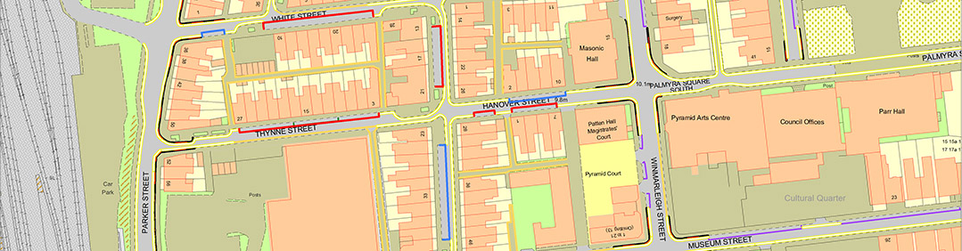
The ‘schedule’ element of the TO provides information to define the geographical position and physical extent of the restriction. How long should a yellow line be? Which street should be restricted to residents’ parking? Between what times should parking be prohibited in that area Originally, schedules were always text documents providing a description in words of the location and extent of the restriction. However, words are open to interpretation and anyone who has worked in a local authority parking department for any length of time can probably regale you with stories about mis-interpretations and the consequences, As the years have passed, technology has moved forward enormously so we are now at a stage where schedules can be provided in the form of maps. All of which has sparked an inevitable debate. Schedules as maps are being advocated by some powerful institutions, such as Parking and Traffic Appeals Service (PATHS) — one of the adjudicating bodies dealing with appeals by motorists against penalty charge notices, and in the Guidance for New Procedures for Traffic Orders, due to be issued by the Department of Transport.
In some ways, the argument in favour of mapping schedules is strong, There has never been a standardised approach to text schedules, and this has led to problems of interpretation. For example, one person’s understanding of from the junction of High Street and Market Place” can be very different from that of someone else, depending on how you define “junction”.
Inevitably, there is room for human error, Lengthy pages of text, complicated drawings and convoluted descriptions can lead to all sorts of mistakes, Map-based schedules, on the other hand, call on the user to have the skill-set necessary to use the technology, as well as assuming a certain standard of map-reading ability. This becomes very relevant in areas that are heavily built up, as the map can become very crowded. These schedules are also more expensive, and more time-consuming to implement, than text-based equivalents. However, one advantage they do hold, is that they break down communication barriers. Through the use of clearly marked maps, restrictions become transparent to anyone for whom English is not their first language, as is often the case. The schedules also give a more easily defined and consistent approach and, once the user is familiar with the technology and mapping system, they are easier to apply to any situation.
So which side is the winner?
The map-based schedule is visually appealing, more easily understood and user-friendly and provides a clearer audit trail of changes and developments. All of these have to be advantages but the conversion can be an exercise requiring high skill levels and some cost.